Historic Jackson Covered Bridge (New Hampshire) by Todd Henson

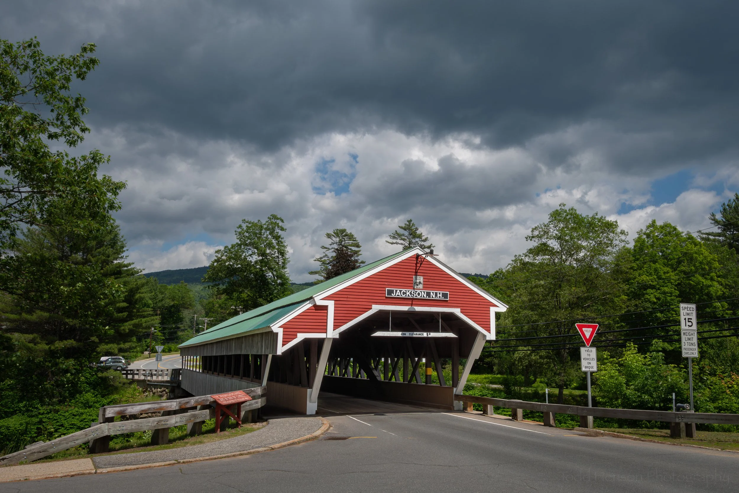
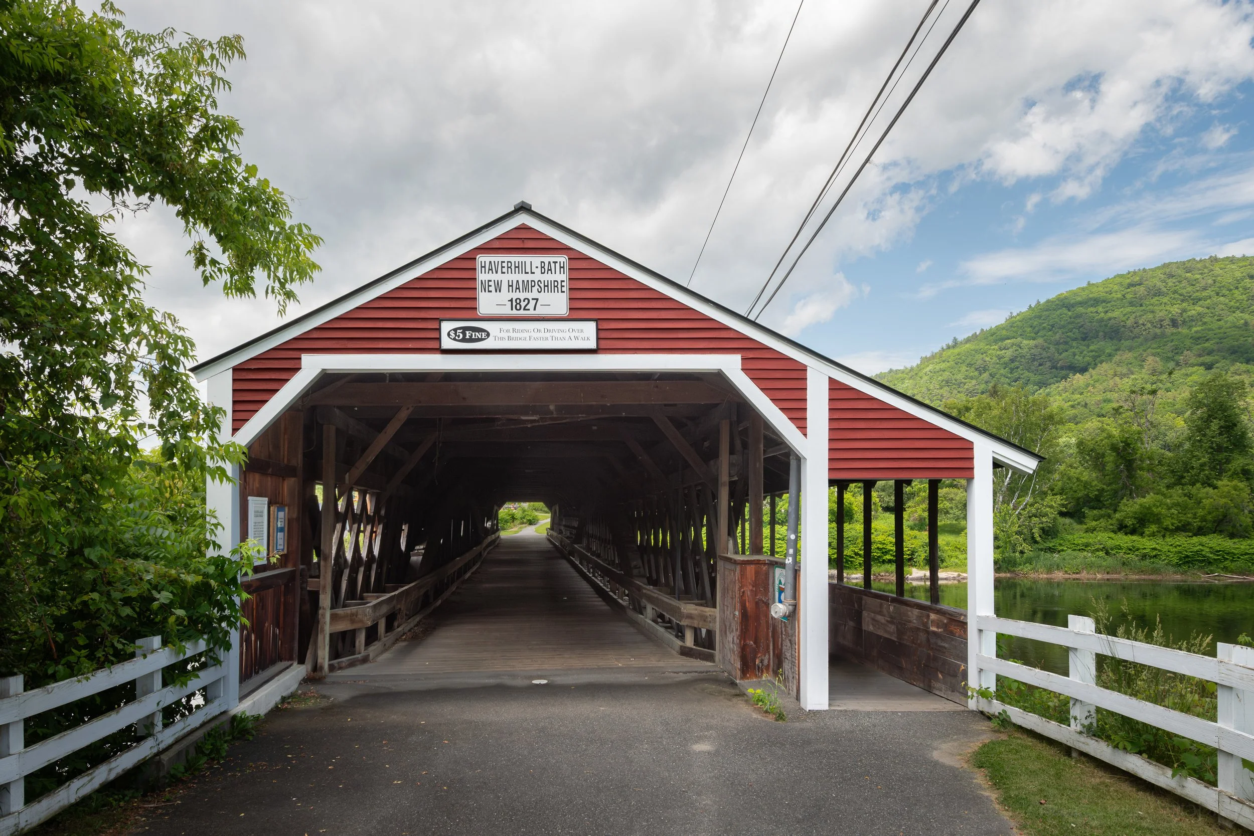
The Historic Jackson Covered Bridge in New Hampshire is sometimes referred to as the Honeymoon Bridge.

Jackson, New Hampshire, has been considered a resort or vacation destination since the mid-nineteenth century and has a covered bridge well suited to that crowd. The Jackson Covered Bridge may be one of the most photographed bridges in the country, and in fact, has been photographed by the Anheuser Busch Company with the Clydesdales Horses riding through the bridge. It’s sometimes referred to as the Honeymoon Bridge.

The single span Jackson Covered Bridge in New Hampshire.

Facing the Jackson Covered Bridge.

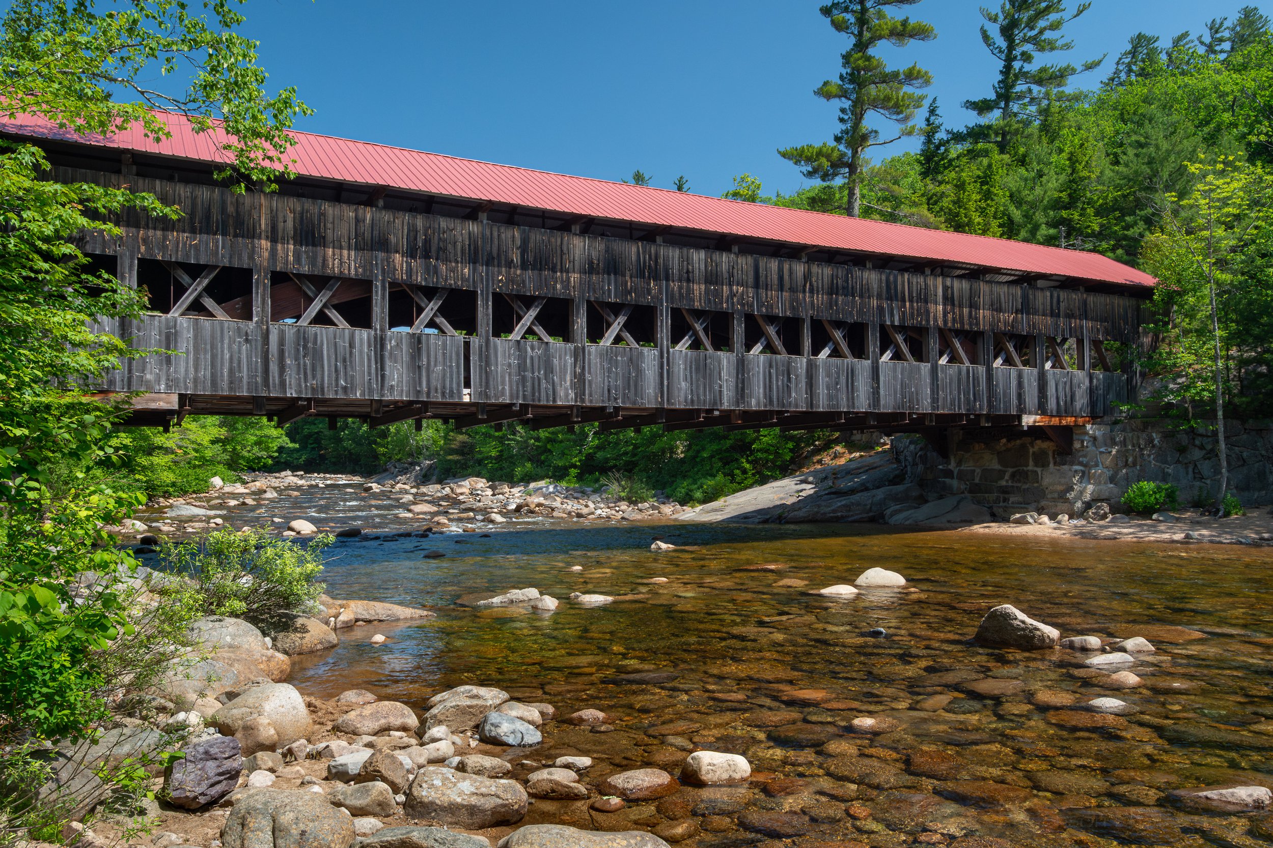
There may be some uncertainty as to exactly when the town built the bridge, but a sign at the location states it was 1876. The bridge uses a Paddleford truss structure with arches, as can be seen in the interior photograph. It includes a single pedestrian walkway separated from the main vehicular path. The bridge spans the beautifuly rocky Ellis River.

A view inside the Jackson Covered Bridge at the single span Paddleford truss with arches.

Looking down at the Ellis River from the end of the Jackson Covered Bridge.

As is sometimes the case, it has required repair work over the years, both to deal with damage caused by crashes and just the general wear and tear of wooden structures. It underwent a major renovation in 2003 with much of the bridge being reconstructed to deal with rot and decay, though some of the boards with historic carvings were preserved and reinstalled. After the renovation was completed in 2004 the town held a “Once in a Blue Moon” dance on the bridge to celebrate the reopening.

The Jackson Covered Bridge is number 51 in the New Hampshire list of covered bridges. We visited this bridge on June 22nd, 2025. Click here to see the list of covered bridges we visited while traveling through New Hampshire in mid-2025.

I was fortunate to get smiles from a couple bikers driving through the Jackson Covered Bridge.

Resources

Most of the details within this post were learned either from signs at the bridge or from the fantastic book, Covered Bridges of New Hampshire by Kim Varney Chandler, which I purchased from a small local shop in Lincoln while on our trip. It’s well worth it if you plan to visit the area or are just interested in covered bridges and their history and construction. The link takes you to the author’s website for the book with lots of extra information and with links to let you purchase directly from her.


Do you enjoy these posts?

Sign up to receive periodic emails with updates and thoughts. Don’t worry, I won’t spam you. And please consider purchasing artwork or products from my online store, and using my affiliate links in the sidebar to the right when shopping online.

I appreciate your support!


Looking Back Along the Abandoned Rails by Todd Henson

Looking Back Along the Abandoned Rails

A rainy, foggy day. Late October. Standing on the old, abandoned rails, peering into the cloudy and uncertain distance. Looking back, who used to pass this way? Where were they coming from, and where were they traveling to? A light misty rain touches my face, moisture collecting on my beard, as I ponder the history of these rails.


Do you enjoy these posts?

Sign up to receive periodic emails with updates and thoughts. Don’t worry, I won’t spam you. And please consider purchasing artwork or products from my online store, and using my affiliate links in the sidebar to the right when shopping online.

I appreciate your support!


Historic Albany Covered Bridge (New Hampshire) by Todd Henson

Facing the Albany Covered Bridge in New Hampshire

The Albany Covered Bridge is located just off the extraordinarily scenic Kancamagus Highway not too far west of Conway, New Hampshire. It is within the White Mountain National Forest and is maintained both by the town of Albany and the United States Forest Service. It was originally constructed in 1858, and a sign on the bridge states it was renovated in 1970.

The Albany Covered Bridge as seen from the Swift River in New Hampshire

Albany Covered Bridge is an example of a single-span Paddleford truss with arches, which can be seen in a couple of the photos. It’s 120 feet long and spans the Swift River. It was once used by scattered farms along the road, giving them easier access to nearby Conway where they could stock up on groceries and needed supplies, and giving them a chance to send and receive mail. Now Conway is just minutes away by car but at the time it could take 3 hours on a good day for the wagons of the day. As a sign at the parking lot states, the road remains, the community fades away. Now it’s used mainly by locals and tourists.

Here I put on a fisheye lens to capture more of the Albany Covered Bridge and the Swift River in New Hampshire

The Albany Covered Bridge is number 49 in the New Hampshire list of covered bridges. We visited this bridge on June 24th, 2025. Click here to see the list of covered bridges we visited while traveling through New Hampshire in mid-2025.

Driving through the Albany Covered Bridge in New Hampshire

Resources

Most of the details within this post were learned either from signs at the bridge or from the fantastic book, Covered Bridges of New Hampshire by Kim Varney Chandler, which I purchased from a small local shop in Lincoln while on our trip. It’s well worth it if you plan to visit the area or are just interested in covered bridges and their history and construction. The link takes you to the author’s website for the book with lots of extra information and with links to let you purchase directly from her.


Do you enjoy these posts?

Sign up to receive periodic emails with updates and thoughts. Don’t worry, I won’t spam you. And please consider purchasing artwork or products from my online store, and using my affiliate links in the sidebar to the right when shopping online.

I appreciate your support!