The unincorporated village of North Stratford is part of the town of Stratford in Coos County, New Hampshire. It borders the Connecticut River with Vermont on the western side. The town of Stratford was incorporated in 1773, originally called Woodbury. The village of North Stratford, located on land that was once the farm of the Fuller family and was occupied during the War of 1812, had its beginnings around 1848 when brothers Elisha and William Baldwin settled in the area and built the first saw (for lumber) and grist mills, and shortly after this a bridge across the Connecticut River to Vermont. In 1853 the location was chosen for a northern expansion of the railway, further accelerating the growth of the area into a thriving community.
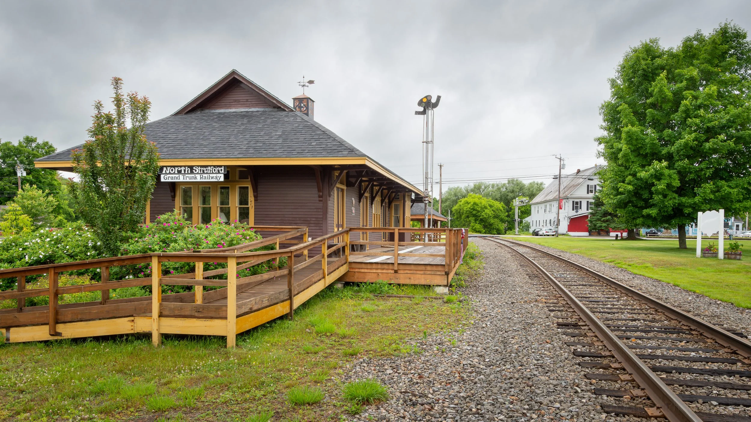
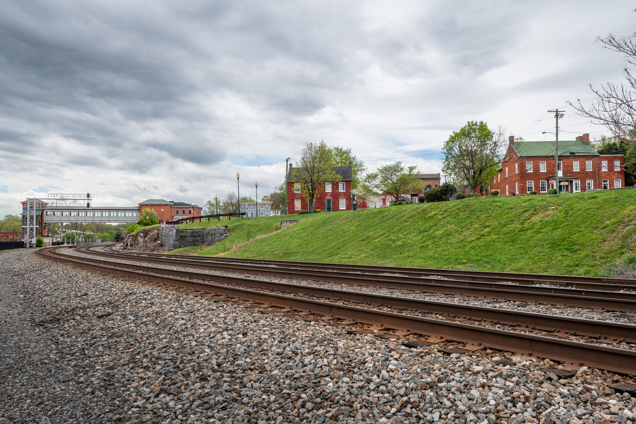
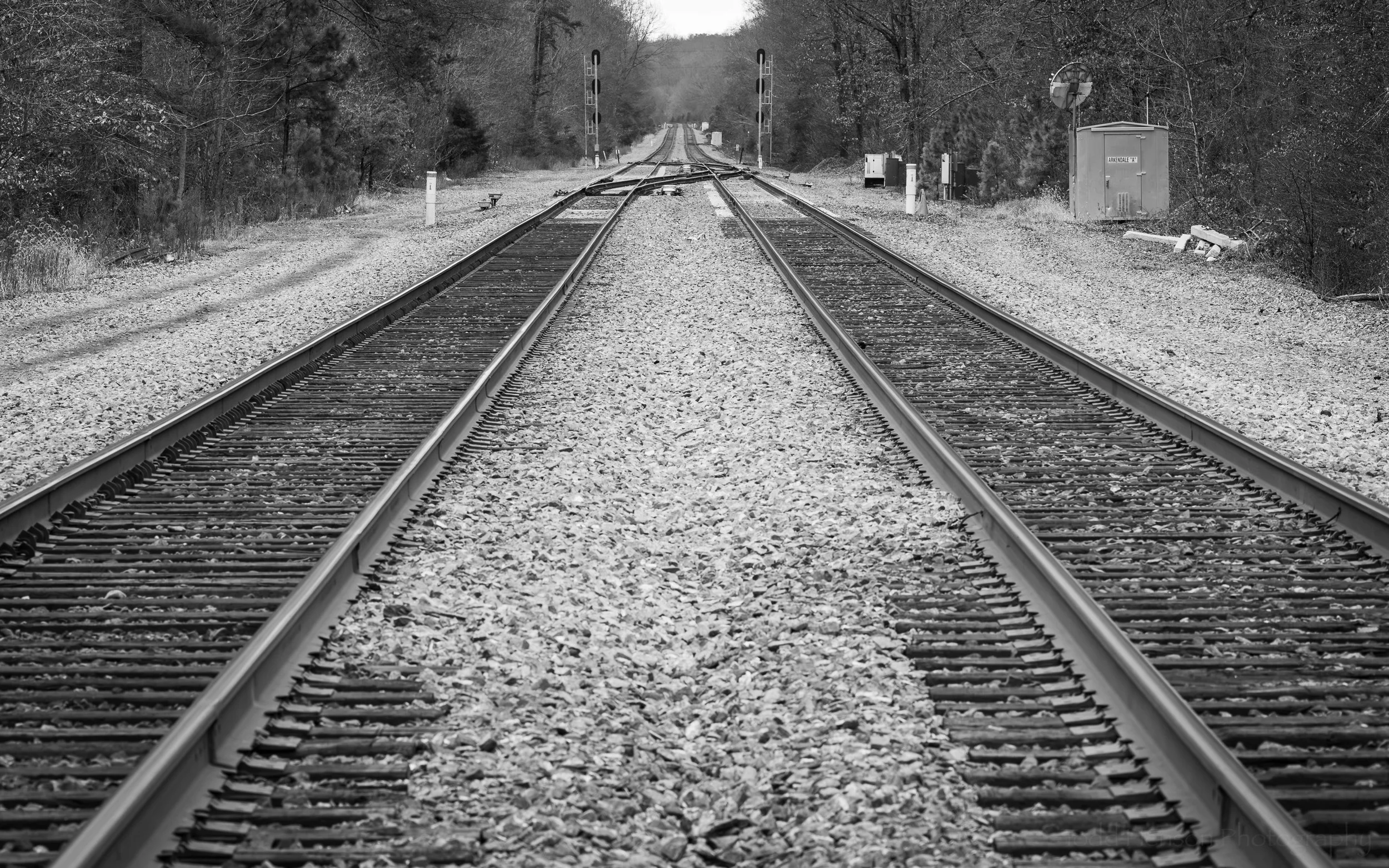
North Stratford Grand Trunk Railroad Station and Stratford Public Library
North Stratford Grand Trunk Railway Station and Stratford Public Library
The railway was originally known as the Upper Coos Railroad and later as the North Stratford Railroad. Before long the Grand Truck Railroad leased the station and connected their Toronto-Montreal line with the existing Montreal-Portland line, making North Stratford part of a major transportation route.
The renovated North Stratford Grand Trunk Railway station is now the Stratford Public Library
Much later the North Stratford Railroad ceased operations as more and more freight was transported in trucks on roadways. The North Stratford Grand Trunk Railroad Station was renovated and converted to the Stratford Public Library, which seems a very fitting way of keeping its history alive.
The Stratford Public Library beside the rails
First Baptist Church of North Stratford
The First Baptist Church of North Stratford
The Baptist denomination in the larger Stratford area dates back to around 1836. As mentioned above, the village of North Stratford began forming around 1848 by the Baldwin brothers, and grew with the construction of mills, the railway and the bridge over the river. Church services were initially held in schoolhouses and homes but with the growing community Elisha Baldwin bought a plot of land and building of the First Baptist Church of North Stratford began in either 1852 (as stated on a plague in front of the church) or 1855 (as stated in the History of the Town of Stratford, New Hampshire, 1773-1925 by Jeannette R. Thompson). The church was destroyed by fire twice, in 1868 and again in 1915, but in both cases it was quickly rebuilt. The current structure was rebuilt in 1915 and dedicated in January of 1916.
A front view of the First Baptist Church of North Stratford
Front details of the First Baptist Church of North Stratford
I hope you’ve enjoyed this bit of history and these views into two elements of the small community of North Stratford, New Hampshire, located in a beautiful part of the state. The area was once largely owned by paper companies, but the forests have been recovering over the years, with a benefit that the logging roads and camps have allowed for forest recreation and this part of the state is now a popular destination for outdoor activities.
Do you enjoy these posts?
Sign up to receive periodic emails with updates and thoughts. Don’t worry, I won’t spam you. And please consider purchasing artwork or products from my online store, and using my affiliate links in the sidebar to the right when shopping online.
I appreciate your support!