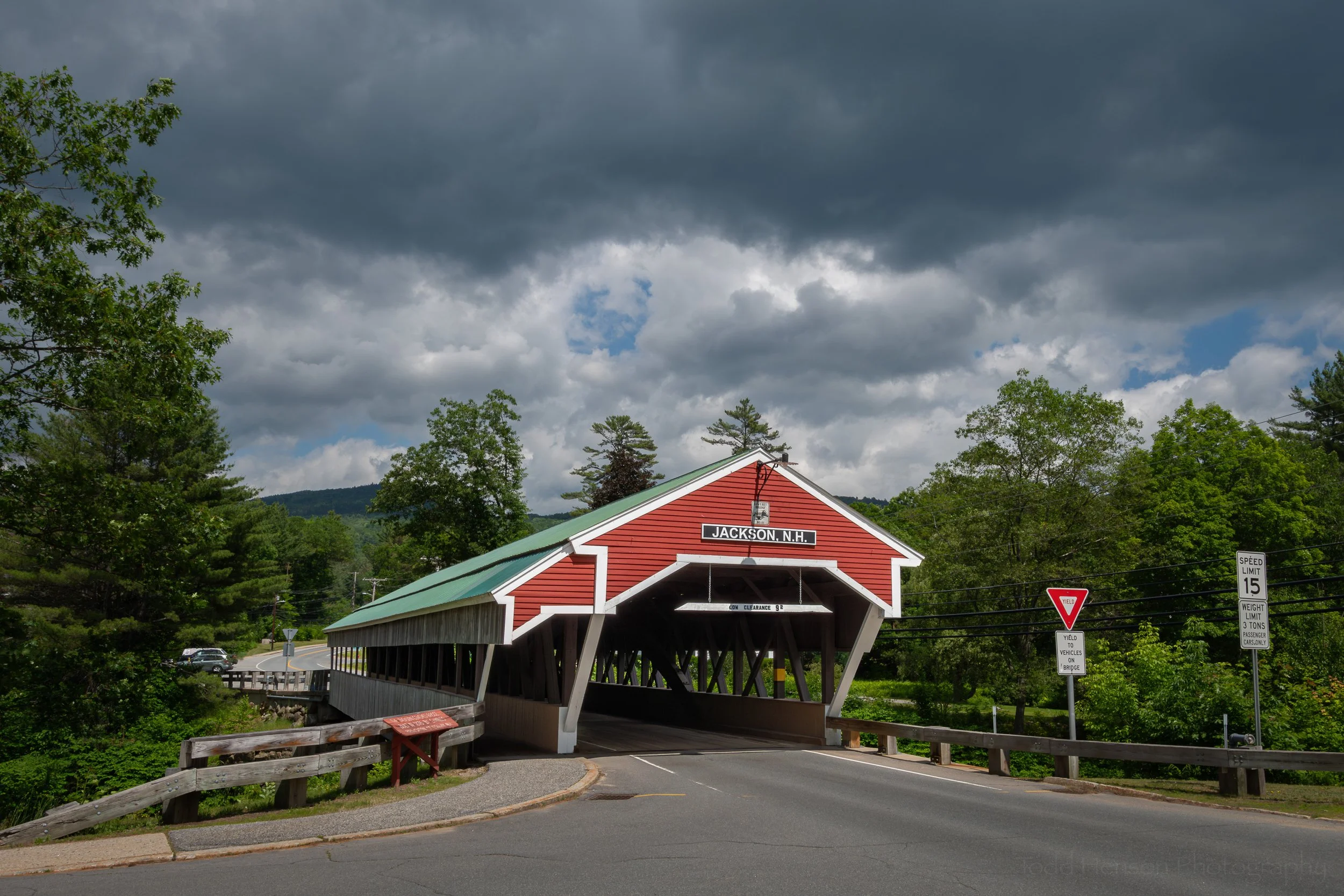
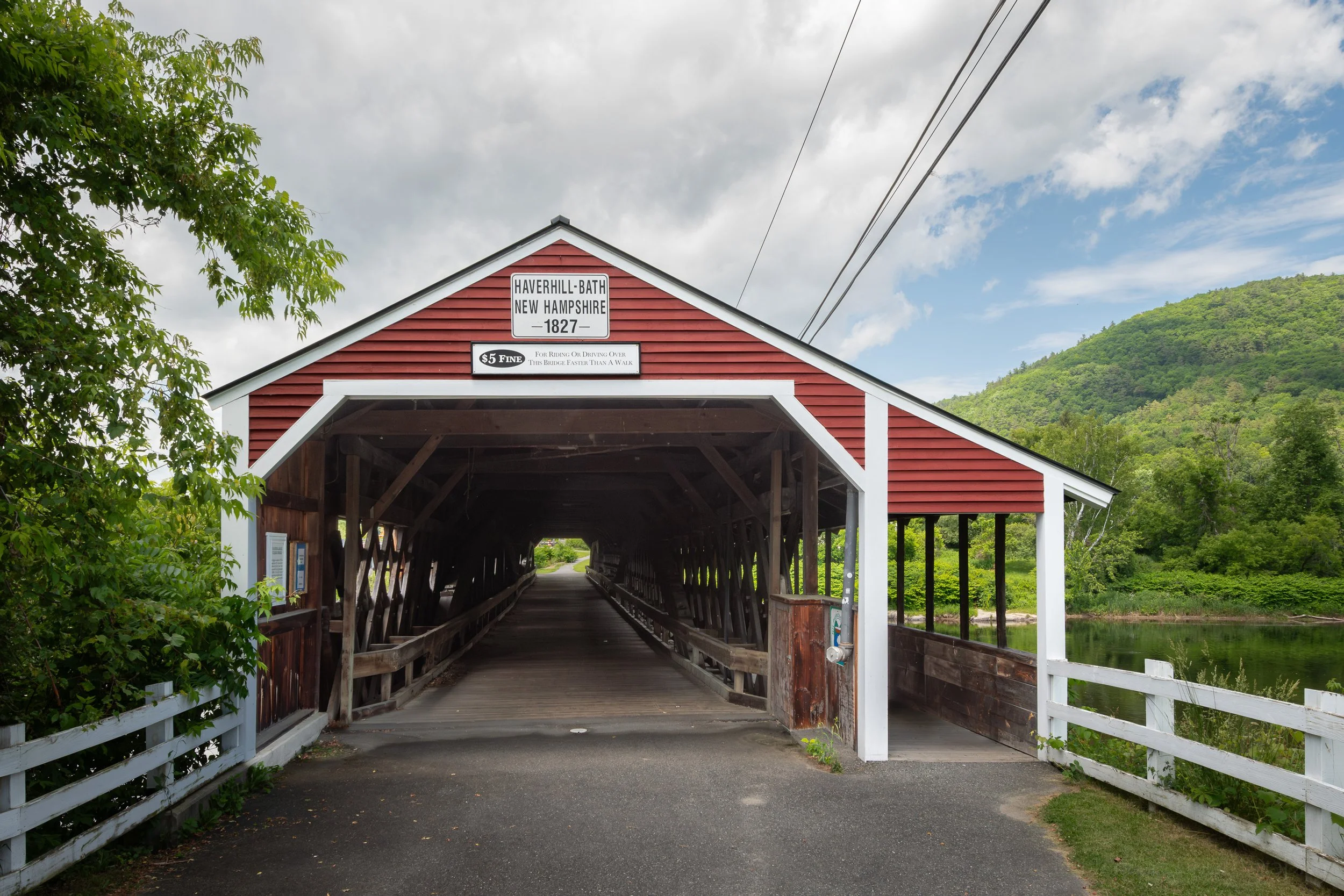
The Haverhill-Bath Covered Bridge
The signs above the Haverhill-Bath Covered Bridge in New Hampshire show the year 1827, which is the year the bridge was planned. It wasn’t actually completed until 1829. Even so, it is the oldest covered bridge in New Hampshire and one of the oldest in North America. Unlike many other covered bridges, it’s the first and only bridge at this location, as stated on a sign inside the bridge.
The Haverhill-Bath Covered Bridge as seen from the Raymond S. Burton Bridge. In this wide view I wanted to include as much as possible so I stitched multiple wide angle photos into this panoramic image and there is a little distortion with the bridge appearing bowed in the middle, which it is not.
A view of the two-span Haverhill-Bath Covered Bridge
A path leads down to the rocks and the river with the dam and hydroelectric plant on the Woodsville side
The Haverhill-Bath Covered Bridge is a two-span Town lattice truss, following the patent of Ithiel Town. It is the oldest Town lattice truss still in existence. It spans the Ammonoosuc River (Abenaki for “small, narrow fishing place”) just before that river flows into the Connecticut River at the village of Woodsville, part of the town of Haverhill, with the town of Bath on the other side of the Ammonoosuc.
Facing the Haverhill-Bath Covered Bridge, about to walk back across to the parking lot a little ways beyond
Walking through the Haverhill-Bath Covered Bridge showing some of the lattice structure inside
Another view inside the Haverhill-Bath Covered Bridge, showing the arches installed for extra support
Looking out from the Haverhill-Bath Covered Bridge at the calm Ammonoosuc River above the dam
An interior detail view of some of the support structures showing both Town lattice truss and arches
The passing of time can be hard on wooden covered bridges, especially when they were only designed to carry the weight of a horse and buggy. Instead of replacing the bridge the two towns decided to reinforce it, adding arches between 1921-1922. They also added the pedestrian sidewalk, which I quite like as it completely separates pedestrians from automotive traffic. But by 1999 it was time to completely remove automotive traffic from the bridge, so the nearby Raymond S. Burton Bridge was constructed. Thankfully, the towns have continued to maintain the covered bridge and still allow pedestrians to cross, enjoying this piece of local history.
The pedestrian sidewalk inside the Haverhill-Bath Covered Bridge
Two bridges, the Haverhill-Bath Covered Bridge in the foreground and the Raymond S. Burton Bridge in the background.
Walking over the Raymond S. Burton Bridge with the Haverhill-Bath Covered Bridge just visible on the right.
The Haverhill-Bath Covered Bridge is number 27 in the New Hampshire list of covered bridges. We visited this bridge on June 19th and 25th, 2025. Click here to see the list of covered bridges we visited while traveling through New Hampshire in mid-2025.
Resources
Most of the details within this post were learned either from signs at the bridge or from the fantastic book, Covered Bridges of New Hampshire by Kim Varney Chandler, which I purchased from a small local shop in Lincoln while on our trip. It’s well worth it if you plan to visit the area or are just interested in covered bridges and their history and construction. The link takes you to the author’s website for the book with lots of extra information and with links to let you purchase directly from her.
Do you enjoy these posts?
Sign up to receive periodic emails with updates and thoughts. Don’t worry, I won’t spam you. And please consider purchasing artwork or products from my online store, and using my affiliate links in the sidebar to the right when shopping online.
I appreciate your support!